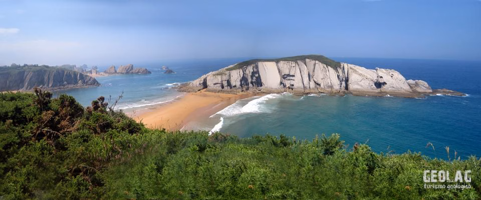
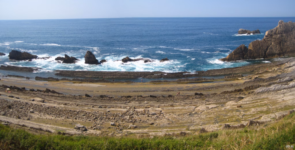
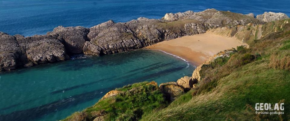
The Costa Quebrada of Cantabria is a spectacular coastal landscape where the rocks tell the story of the opening of the Cantabrian Sea and the uplift of the Cantabrian Mountains. Between San Juan de la Canal and Somocuevas, the cliffs, islets, coves and beaches display limestones, marls, sandstones and fossils formed in ancient warm seas millions of years ago. A fascinating geological journey to understand how tectonics, marine erosion and the passage of time have shaped one of the most unique coastal stretches of the Cantabrian Sea.
The Costa Quebrada coastline is listed in the Inventory of Geological Points of Interest of the IGME (Geological and Mining Institute of Spain), and included in the Natura 2000 Network as Special Conservation Areas.
About 150 million years ago, the Iberian Peninsula was located in a different position from the one it currently occupies. The Peninsula was attached to Northern Europe so that Galicia and Brittany were initially united. In the Cretaceous, between 140 and 65 million years ago, the Iberian Peninsula began to rotate with respect to the European continent, opening a sea between them that corresponds to the current Cantabrian Sea, thus giving rise to the appearance of our coastline. In the last period of the opening process of the Cantabrian Sea (between 115–60 million years ago) the rocks that today constitute the cliffs of Costa Quebrada were deposited.
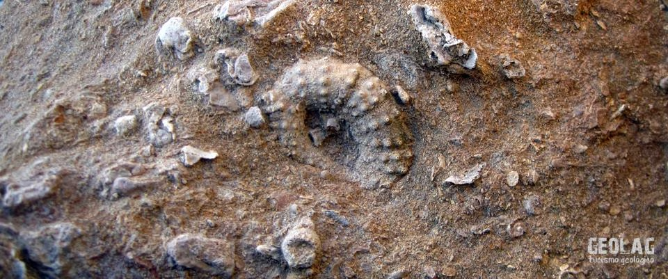
At that time Asturias was under a warm and shallow sea where reef organisms such as corals and some types of molluscs proliferated, giving rise to the formation of limestones. Due to an increase in continental sedimentary inputs, a series of detrital sequences of siltstones and sandstones were deposited. Thus in this sector of the Cantabrian coast we find a whole range of limestones with greater or lesser inputs of materials from the erosion of continental areas generating a variety of rocks such as calcarenites, clayey limestones, marls, sandy limestones, etc., many of them with significant fossil content.
About 45 million years ago, as a consequence of Africa’s push against the Iberian Peninsula, the opening of the Cantabrian Sea was interrupted and the rocks initially deposited as horizontal layers were deformed and uplifted, forming the current Cantabrian Mountains. In this orogenic context, these rocks were folded into a large syncline that extends from the Santander peninsula to the southwest.
Costa Quebrada is the northern flank of this syncline, so on our route, from San Juan de la Canal to Somocuevas, the age of the rocks will be progressively older, covering a period of time ranging from the Lower Cretaceous to the Eocene.
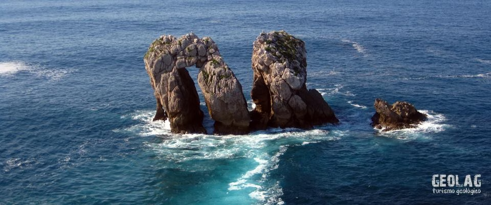
In general, these are rocks with little resistance to erosion, so this entire sector is subject to intense and continuous erosion by coastal processes. Consequences of this erosion are the numerous islets observed in this coastal sector, as well as the coves that host the main beaches and the numerous collapses observed on the cliff, some of large dimensions, such as the one found in Arnía.
Would you like to discover this landscape with a geologist?
GEOLAG organizes educational routes adapted to families, groups and educational centers.
Request information about this route