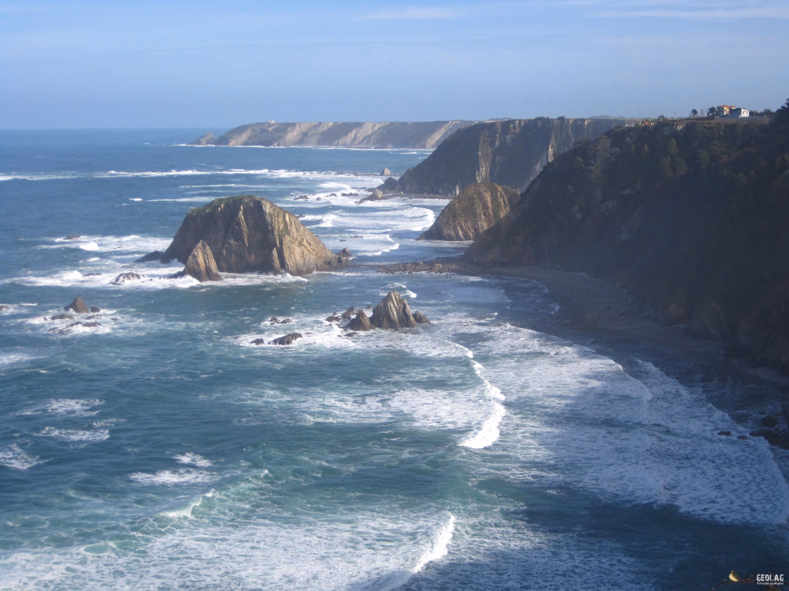
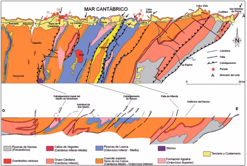
The western coast of Asturias extends from the mouth of the Nalón river to Galicia and is characterized by steep cliffs up to 100 m high. At the base of these vertical cliffs there are more than 100 beaches. Generally, these are pebble beaches attached to the cliff composed of quartzite pebbles and to a lesser extent gravel. But certainly what characterizes the western coast is the practically continuous presence of coastal rasas, which make the top of the cliffs acquire a perfectly flat surface that extends towards the horizon.
This surface was carved during the Neogene-Pleistocene by the sea and at that time constituted the active abrasion platform, identical to the one that currently exists at the base of most of the western cliffs and which is clearly visible during low tides.
The rocks that form this part of Asturias are located in the so-called West Asturian-Leonese Zone and are among the oldest, ranging fundamentally from the Precambrian to the Silurian. It is a thick succession of rocks more than 12,000 m thick where alternations of sandstones and shales predominate, which were deposited in a large sedimentary basin formed about 590 million years ago when the Iapetus or Proto-Atlantic ocean began to form. These materials came from a somewhat higher relief located to the east called the Cantabrian-Iberian Threshold.
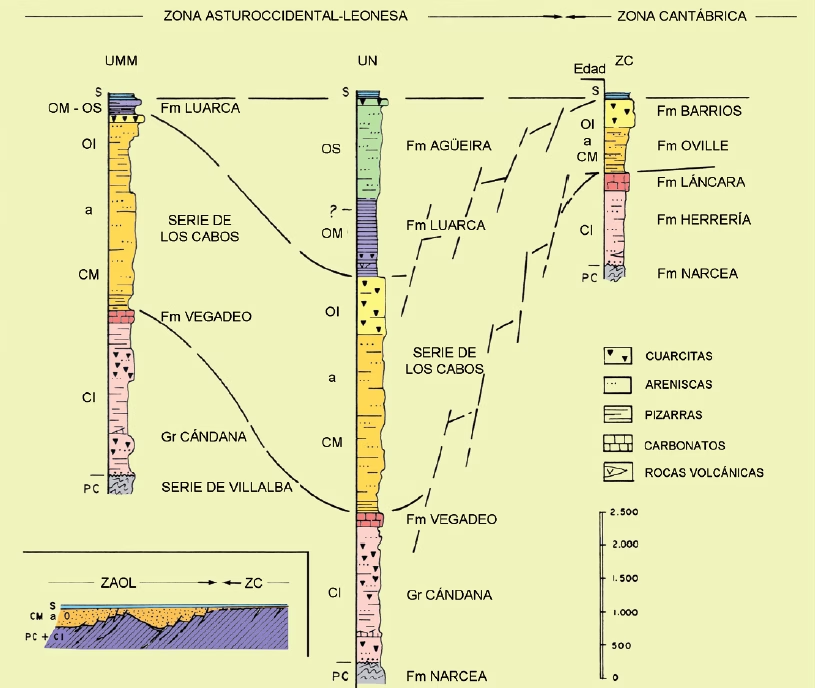
Tectonically, the west represents the beginning of the internal zones of the Variscan orogen, so the rocks present significant internal deformation and low-intensity regional metamorphism that increases towards the west.
As a result of the intense deformation suffered by this part of the earth’s crust, a series of thrust sheets have formed that repeat the rock succession, and folds are very abundant, which towards the west become larger and their axes become more horizontal (recumbent folds). A detailed study of the rocks allows us to differentiate at least three deformation phases that extended from the Silurian to the Carboniferous.
Would you like to discover this landscape with a geologist?
GEOLAG organizes educational routes adapted to families, groups and educational centers.
Request information about this route