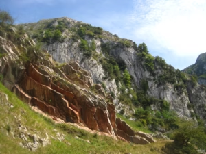
Somiedo Lakes: glacial origin, dolomites and a geological route
Why are there lakes in an area dominated by limestone? The Somiedo Lakes hide a story of glaciers, dolomitisation, iron mining and unique high-mountain landscapes in Asturias.

Why are there lakes in an area dominated by limestone? The Somiedo Lakes hide a story of glaciers, dolomitisation, iron mining and unique high-mountain landscapes in Asturias.
The Route of the Xanas lets you discover one of Asturias’ most spectacular gorges through a geological lens. A trail through limestone, sandstone, faults, folds and water-carved landscapes, ideal for interpreting the formation of this gorge between Proaza, Serandi and Pedroveya.
Discover Costa Quebrada, jewel of Cantabria and Natura 2000 Network. From San Juan de la Canal to Somocuevas, be amazed by its ancient islets and cliffs. A geological landscape that will captivate you!
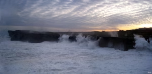
The Asturian coast is a living landscape where beaches, cliffs, dunes, estuaries, and coastal platforms (rasas) tell the geological history of the northern Iberian Peninsula. Along its more than 350 km of coastline, between the Tinamayor and Eo estuaries, the variety of rocks and structures dictates the shape of the coast: from the cliffs and pebble beaches of the west to the limestone landscapes of the east, including the large sandy areas and dune systems fed by rivers. An educational journey to understand how the sea, rocks, sediments, and time have modeled one of the most diverse coastlines of the Cantabrian Sea.
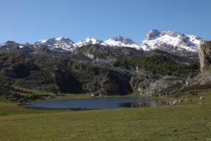
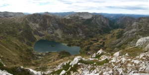
The route through the Covadonga Lakes allows you to discover one of the most emblematic landscapes of the Picos de Europa National Park, combining nature, history, glacial geology, and cultural heritage. From the Pedro Pidal Interpretation Center to the old Buferrera mines, Lake Ercina, Vega del Bricial, and Lake Enol, the route shows how glaciers, moraines, karst, and mining activity have shaped this unique environment. An easy family excursion to understand the origin of the lakes, the power of ice, and the close relationship between the mountains, shepherds, and the memory of Covadonga.
The Samuel Path PR-AS-284 is a low-difficulty circular route that combines nature, geology, and local history between Llames de Pría, Cuerres, and Ribadesella. Along the Guadamía River, the path reveals a peaceful landscape of fertile plains, limestone formations, small waterfalls, and unique spots such as the medieval Mía bridge, with the option to extend the walk to the impressive Bufones de Pría.
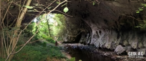
Very close to Vega beach, in the town of Torre, lies the Puente del Arcu, a unique natural formation created by the erosion of the Acebo River on Carboniferous limestones. A short walk through the forest leads to this rock arch, an ancient section of a fluvial cave where subterranean features, such as stalactites and flag formations, are still preserved. Beneath the arch, the ruins of an old flour mill add human history to a geological spot as beautiful as it is unexpected.
The Asturian Dinosaur Coast offers a fascinating journey along the Jurassic cliffs of Caravia, Colunga, and Villaviciosa, where footprints, bone remains, and marine fossils from millions of years ago are preserved. This driving route explores sites such as Vega Beach, the Jurassic Museum of Asturias, La Griega Beach, Rodiles, Misiego Cove, and Tazones, combining geology, coastal landscape, natural heritage, and small, accessible stops for all audiences. An ideal tour to discover how the sea, tides, and Earth’s history continue to reveal the footsteps of the ancient inhabitants of the Jurassic period.
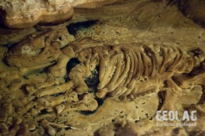
We travel to the municipality of Onís to visit one of the interpretation centers of eastern Asturias. This center of great geological interest is the only cave included within the Association of Spanish Tourist Caves (ACTE).