I am sure many of you have done this well-known route, or at least know something about it. What I am sure of is that many of you will not know how the gorge the path runs through was formed, and that there is the option of doing the route as a circuit starting from the village of Serandi, crossing over to La Rebollá and descending through the gorge back down to the Proaza valley again.
This is a circular route that will take us about 4–5 hours depending on our walking pace. It is about 8 km, and ideally you should go with two cars, leaving one in the Las Xanas car park and the other in the village of Serandi, which we will pick up at the end of our hike. If we only have one car, the route will take an extra hour, as we will need to leave the car in the La Buyera recreation area, to take a path through a gorge that leads us directly to Serandi.
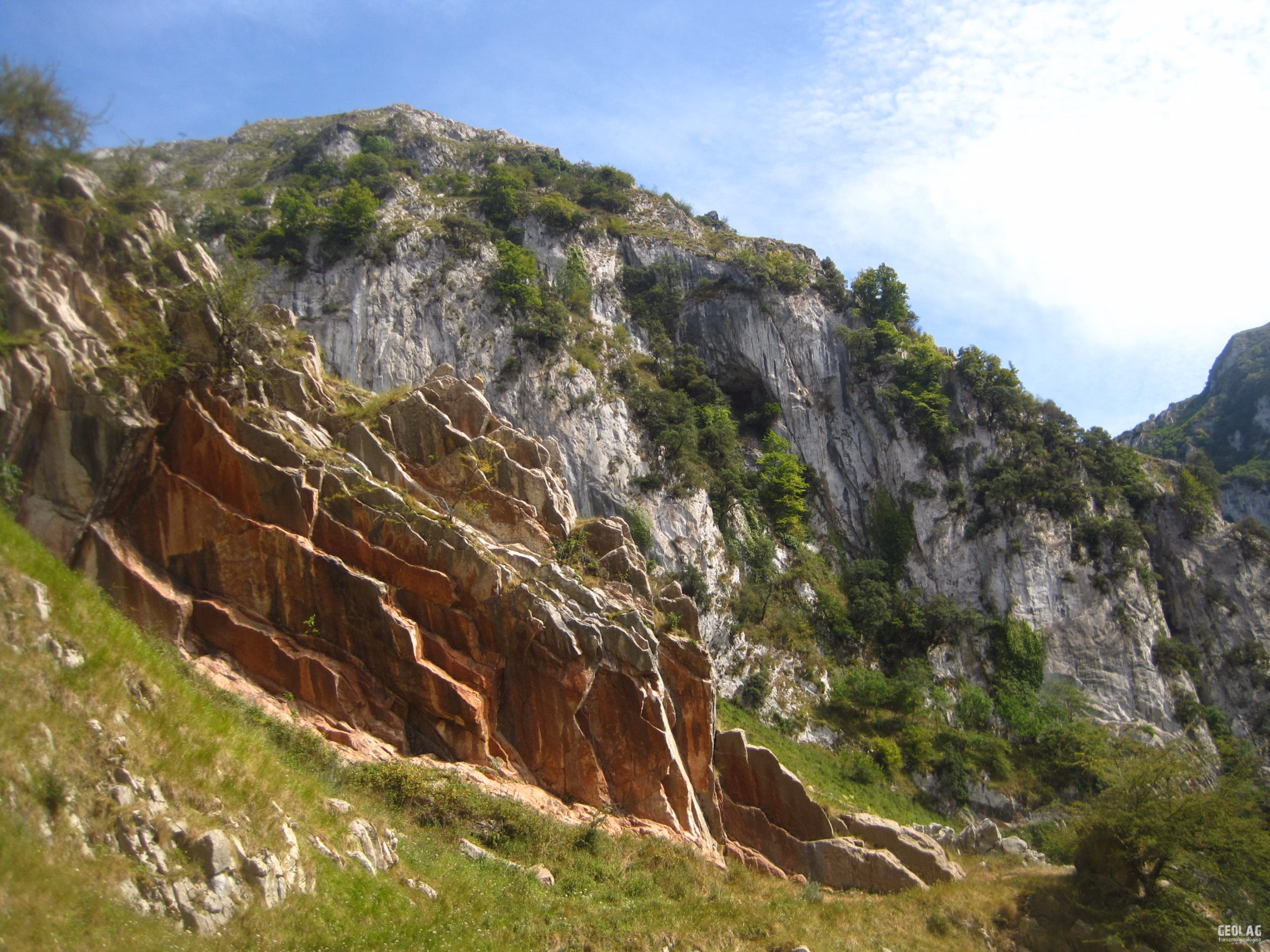
The ascent from Proaza to Serandi follows a hillside with wide meadows, where the villages of Piniella and Villamejin are also located. These pastures are possible thanks to the presence of a slate and sandstone substrate of Carboniferous age, which generally produces very fertile soils. From Serandi we must take a concrete track heading NW, which soon becomes a path. After passing a metal gate, we should look out for a turn-off to the left level with a meadow with two ash trees and a house, because if we lean over the edge of that plot and climb onto some rocky ledges on the left, we can enjoy a splendid and original panoramic view of the entire Las Xanas gorge with Pedroveya in the background. From this point you can see the path carved into the limestone rock that forms the gorge, as well as the rocks that make up this gorge, now in a vertical position after being affected by the Hercynian and Alpine orogenies. In front of us we can make out the presence of two broad hollows covered by herbaceous vegetation, alternating between several limestone packages. These hollows are occupied by Devonian sandstones which, being softer rocks, end up forming lower-lying areas in the landscape, giving rise to valleys and hollows like the ones before our eyes. They are also siliciclastic rocks, which is reflected in the landscape by a radical change in the type of vegetation, contrasting with that found all around, made up of limestone. Around these hollows, up to three limestone units of Carboniferous age can be observed.
The Devonian rocks in the hollows are reddish sandstones known as the Naranco Formation, as it is on this mountain where they are best represented. Above the Devonian sandstones, some limestones can be seen, among which it is easy to distinguish a more pinkish, more finely bedded level that will catch our attention on our descent through the gorge, as it creates sharp ridges on both sides of the Las Xanas river valley. This is the Alba Fm, known as griotte limestone, a nodular limestone whose thin beds are used in construction. In fact, the renowned Casa Generosa bar in Pedroveya, famous for its home cooking, has an area at its entrance paved with slabs of this limestone. Above the red limestones appears a thick package of light-coloured limestones, the same ones we are standing on at the viewpoint and those that make up most of the gorge. These are the Mountain Limestones, the most abundant limestones in our region. We retrace our steps to return to the main path, and there we will follow the yellow and white markings indicating PR AS-235, which now turn SE. The path runs easily among the rocky outcrops, and hazel woodland becomes increasingly common. The path trends downhill until it reaches a plot of land that we must go around on the outside along its entire left-hand edge. Once around it, we will pass to the left of a cowshed to emerge into an area bare of vegetation, where the path is very clear almost as far as the gap that cuts through the limestone ridge to the east. At this point, where there is a water tank and a meadow with good shade, we can take a break to eat something and rest.
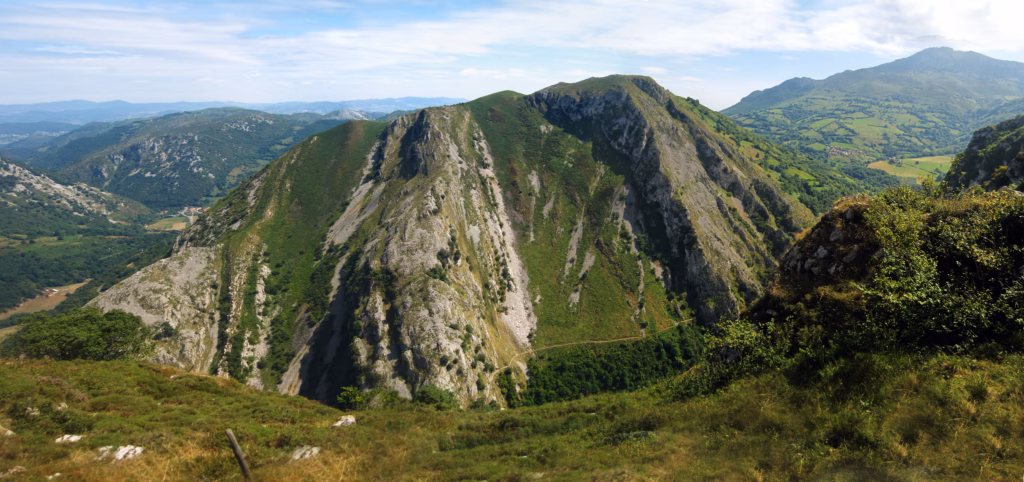
At the pass that leads into the valley where La Rebollá and Pedroveya are located, we will cross the limestone ridge where the grey limestones can be distinguished from the pink, nodular-looking limestones, both Carboniferous. Once on the other side of the ridge, the landscape changes radically, giving way to a broad pass formed on the slates.
We will descend towards the pass and tend to go down along the right-hand side of the hollow that will lead us to La Rebollá, where a washhouse and a trough greet us with their cool waters. We cross the village until we reach a cobbled track that drops steeply and takes us to the crossroads between Pedroveya and the Gorge. If we choose to head towards Pedroveya, we will take the path on the right, which climbs gradually to the village, where the famous Casa Generosa will welcome us to cool off with a good beer. We will notice that part of its façade has been clad with slabs of the pink limestones we crossed at the pass and that we will cross several times on our descent through the Gorge. These limestones are highly valued in construction because their fine stratification means they split easily into sheets.
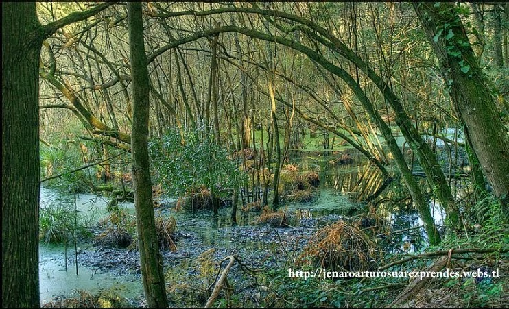
After the break, we will begin the descent into the gorge. Before reaching the gorge proper, we will pass through a wooded area where the river meanders gracefully, forming some pools and waterfalls. As we continue descending, the landscape changes radically, becoming a narrow gorge where the path has been carved. This abrupt change in the landscape is due to the presence of two different types of rocks: on the one hand, the slates and sandstones that form the wooded area, and on the other, the limestones that make up most of the gorge.
Due to the different orogenies that have affected this region, the rocks that appear in the gorge and its surroundings have been strongly compressed, leading to their verticalisation and the formation of faults and folds. That is why, along our descent through the Gorge, we will cross the same grey limestone ridge and the thin layers of pinkish limestones several times, repeated by the action of faults and folds.
As we descend, we will also witness the power of water, which over the last few thousand years has been able to carve gorges of great beauty. In some areas it is even possible to see notches that reflect times when the river was higher, which tells us about the different stages the Las Xanas river has gone through until reaching its current level of incision.
We will also admire the incredible feat of engineering that pierced the hillside in the mid-20th century in order to connect the municipalities of Oviedo, Quirós and Teverga. The drill marks from the dynamite charges used to carve out this iconic path are still visible. On one of the bends in the path, a perfectly flat wall will catch our attention, whose origin is not artificial. It is a fault plane, characterised by its smooth surface scored with striations, formed as a result of the friction produced by the sliding of two blocks of rock during periods of tectonic movement in this region.
The Carboniferous pink limestones that we will cross at different points, forming striking ridges on both sides of the gorge, will not go unnoticed.
In the final part of the route, before reaching the road, we will come across protective structures built to stop the many rock fragments that regularly fall from the slopes as a result of freeze–thaw cycles. This type of deposit is very common at the base of the main rocky escarpments in our region and is known as “scree”. When the escarpments cease to be active, these rock accumulations are quickly colonised by vegetation. In this case, it is a fully active deposit, which is why it has had to be protected with fences to prevent the path from disappearing in this section.
We will soon reach the road that will take us to the car park provided for this famous trail.
You can see some photos of this route on the Facebook page of GEOLAG!!!.
Would you like to discover this landscape with a geologist?
GEOLAG organises educational routes adapted to families, groups and schools.
Request information about this route