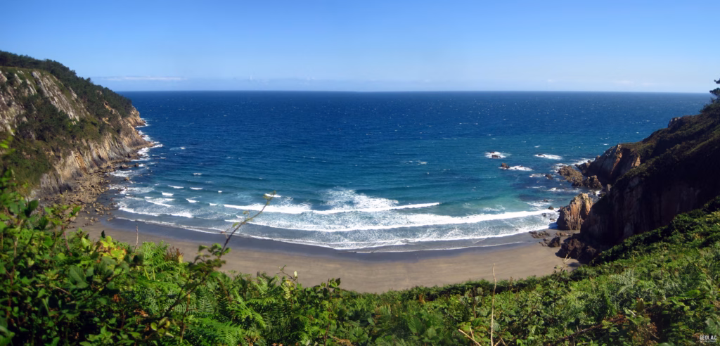
The route we recommend for this summer season winds through the Barayo Partial Nature Reserve, located in western Asturias, between the municipalities of Navia and Valdés. This protected area lies on the boundary between two distinct tectonic and stratigraphic units, a geological setting that has directly influenced the formation of this cove, which is characterized by its immense biological and geological diversity within the Cantabrian coastal region. Sabugo Beach, the Barayo beach-dune system, a complete fluvial-marine system, and the area comprising the tidal flats and cliffs between Canares Cove and Punta de los Aguiones (west of Sabugo Beach) make up the geomorphological units that comprise the Barayo Partial Nature Reserve and constitute a magnificent representation of the Cantabrian coastal environments.
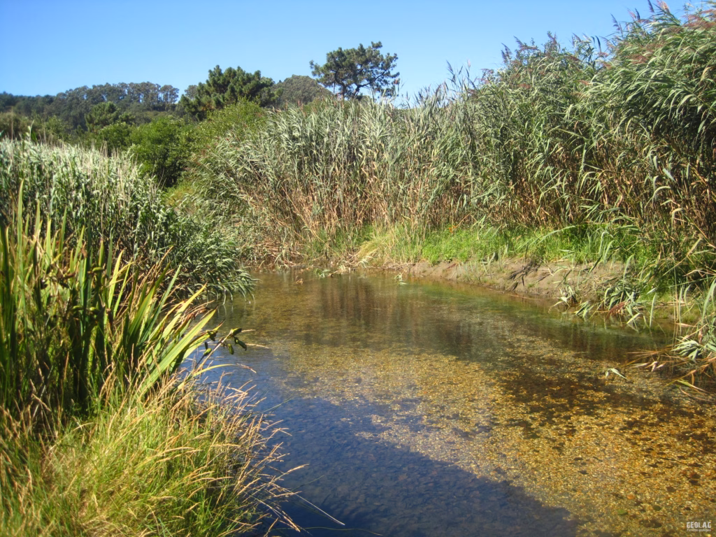
The trail through the Reserve begins at the parking lot in Vigo and follows an easy slope down to the floodplain, where it crosses the Barayo River via a sturdy wooden bridge. The trail winds through reeds and riparian vegetation until it reaches the path leading to the parking lot that has been set up near Villar de Sabugo. Following this trail northward will take us to the western part of the beach, where we’ll cross the dune field and visit the quartzite cliffs at the eastern end of the cove. The route continues along the beach and ends at the mouth of the Barayo River, where a set of steep stairs will lead us back to the parking lot where our vehicles await us.
Extreme caution must be exercised when crossing the river to reach the staircase entrance. When the narrow channel of the Barayo River fills and empties with the tides, the full force of the tide is channeled through it, creating a very powerful current.
Duration: 2 h / 4 h Length: Barayo loop: 2.5 km; round-trip walk to Sabugo: +5 km Elevation gain: 80 m Points of interest: beach-dune system, estuary, marshes, cliffs, caves, salt flats Difficulty: Easy
Coastal plains
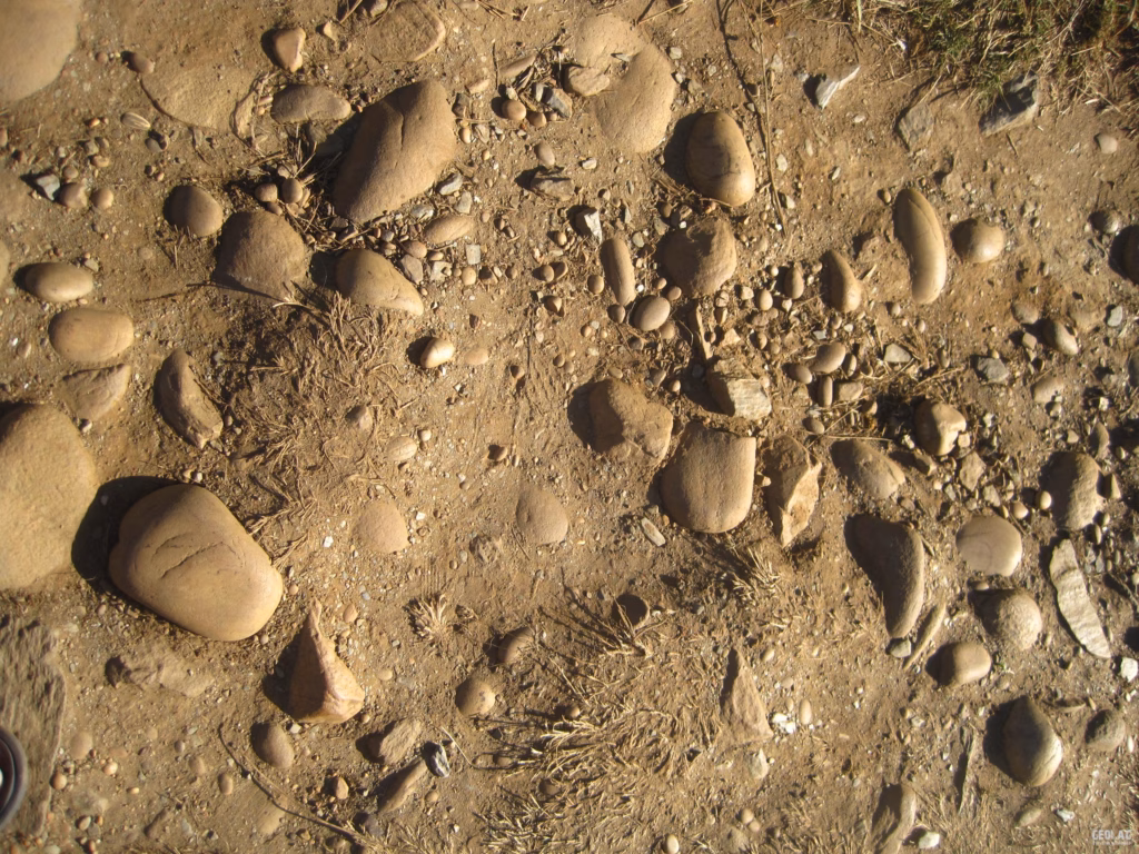
Generally speaking, along the Asturian coastline and in contact with the cliff edge itself, there is a wide strip—up to 4 km wide—with a very flat topography that slopes gently toward the sea, corresponding to an ancient marine abrasion platform. On the western coast, this large platform is cut through by numerous rivers that flow across it in their quest to reach sea level, resulting in the division of this flat plain into distinct sections. In the case of Barayo, the river has cut through this elevated marine abrasion surface, and the resulting topography is a valley bounded by steep slopes that culminate in a flat surface, now elevated to a height of about 80 m due to glacio-eustatic phenomena. On these flat surfaces, the pebble deposits that once contributed to their erosion and polishing are still preserved. These are deposits of rounded quartz pebbles, sometimes several meters thick, and are often associated with sand lenses that also have a marine origin. In the eastern sector of Barayo Beach, there is a landslide that exposes a cross-section where these deposits can be seen. These are, therefore, deposits from ancient beaches that have now been raised, just as the continent itself has been. Along the trail leading from the Vigo parking lot to the beach, we can see numerous examples of these rounded quartzite pebbles. Similarly, in the cliff collapses along the beach, in addition to blocks from the cliff itself, some rounded quartz pebbles can be observed, indicating that these collapses have reached the top of the cliff, affecting the flat-bottomed deposits.
The Barayo Horseback Ride
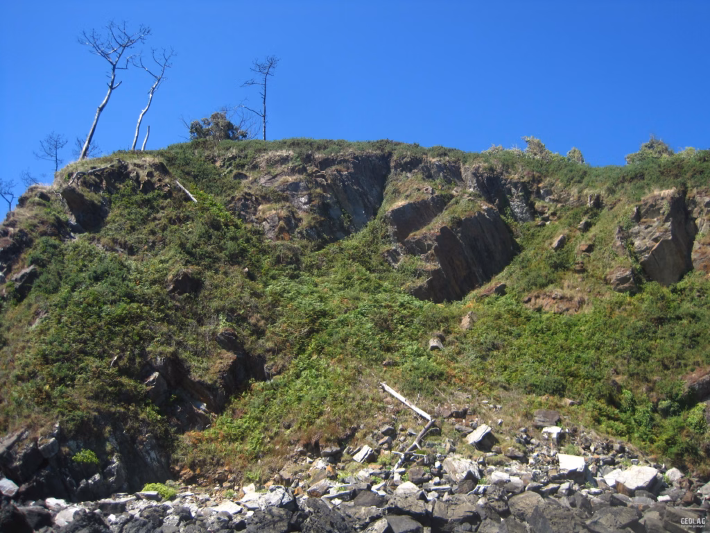
This thrust fault strongly influences the course of the Barayo River, especially in its final stretch, where it follows a straight path that coincides with the direction of this NNE-SSW thrust fault (the same as that of most structures in western Asturias). This major tectonic structure, known as the Barayo thrust fault, brings into contact two types of rock with different behaviors in response to erosion.
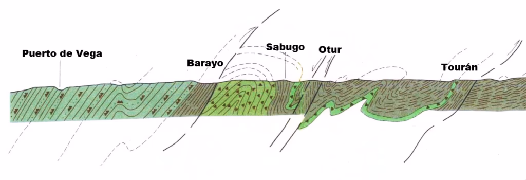
To the east of the thrust fault lie the Ordovician quartzites that make up the so-called “Lower Eo Strata,” consisting of alternating layers of quartzite, sandstone, and shale. These rocks, which are quite resistant to erosion, are part of the so-called Los Cabos Series and are responsible for the formation of Punta de El Cuerno, the eastern boundary of Barayo Cove, which separates this beach from the neighboring Sabugo Beach. In turn, the eastern boundary of Sabugo Beach is formed by the Sabugo Quartzites, a thin layer of quartzite that, along the coast, appears only between Sabugo Beach and Luarca.
To the west of the Barayo overlie, the cliffs are composed of black shales known as the Berducedo layers and of the shales and sandstones of the Agüeira Formation. These darker rock types are what give the sand deposited on Barayo Beach and its dunes its black color. Due to their lower resistance to erosion (both fluvial and marine), the Barayo valley and cove have been carved out of these shale formations.
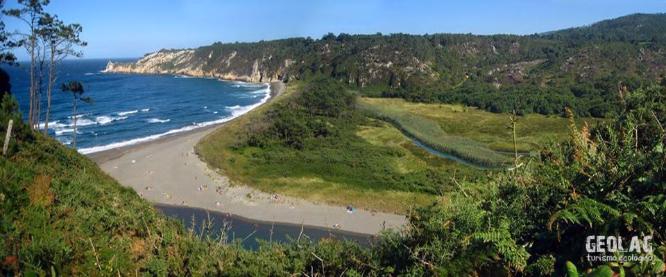
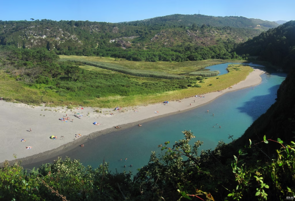
Barayo Beach and Dunes
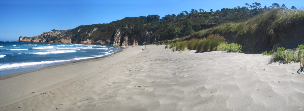
This is a sandy beach more than 600 m long which, due to the presence of the Barayo River channel—through which the tides flow—extends inland for nearly 400 m. The finer materials are carried by northeasterly winds, accumulating at the back of the beach and forming a dune system of great importance (it is the fourth largest in Asturias). Within this dune field, the main dune ridge stands out; it is fully stabilized by vegetation but degraded by the presence of a pine plantation. This dune field is marked by a significant escarpment up to 4 m high, which reveals the erosion to which this system has been subjected. At the foot of this escarpment lies another dune ridge where species such as Euphorbia and grass communities like sea bentgrass are becoming established.
The Barayo River
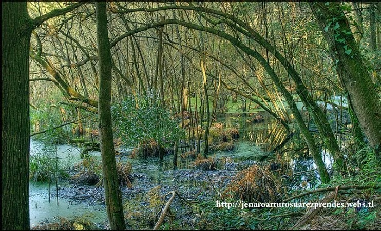
The Barayo River is the central axis around which the entire Reserve is organized, and it is responsible for supplying the beach and dunes with part of the materials that make up this system. It is a coastal river barely 12 km long, which follows the general geological structure of this area, except in the middle section, where the river’s course runs perpendicular to the rock layers—a feature likely influenced by the frequent faults or joints that typically cut through the quartzites. Along its course, riparian vegetation such as alders and willows forms a lush gallery forest. The presence of marshy areas allows for the growth of swampy alder groves and extensive reedbeds and rushes.
Upon reaching the sea, the imposing dune system has formed an effective barrier at the river’s mouth, forcing the riverbed to divert and make a sharp turn westward until it is halted by the sandstone and shale that form the western cliffs, which compel it to complete its journey to the sea right up against the cliff. The influx of tides at high tide through the Barayo River’s channel has created a diverse fluvial-marine ecosystem.
Setback from the cliff
In addition to the contribution of river sediment, the Barayo beach-dune system is fed by sediment carried by coastal currents that sweep along the Cantabrian coast from west to east, transporting material from the rivers and cliffs located to the west of this cove.
In Barayo, there are two good examples of cliff collapses. One is in the western sector, consisting of a debris cone that is currently being eroded by the waves, and another landslide in the eastern sector has left a flat scar, suggesting that the plane along which the landslide slid was a stratification plane. The deposit associated with this landslide has been completely eroded, and only a small portion remains attached to the base of the cliff.
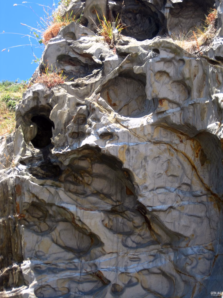
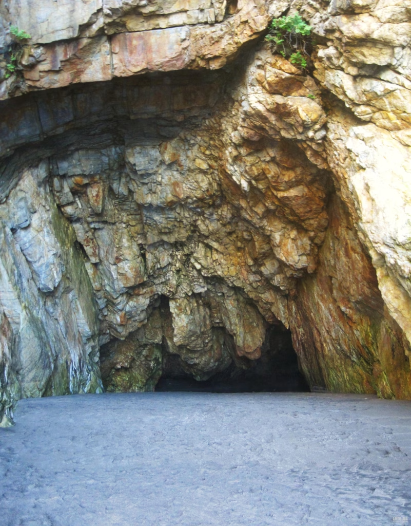
On the quartzite cliffs to the east of the beach, there are some spectacular caves formed by the mechanical action of the waves (unlike karst caves, which are formed by chemical erosion), and whose geometry is related to the different planes of discontinuity found in the quartzite. It is an impressive cave with three entrances on the cliff and a blind gallery. All of these galleries have been carved into the interior of the quartzite massif, following planes of stratification, joints, and faults.
Barayo’s Natural Treasures
There are only about 30 estuaries along the Asturian coast, and most of them are associated with small rivers; they are therefore very rare ecosystems but of great environmental importance.
Despite the presence in the dunes of non-native forest species such as Pinus pinaster—whose presence has caused the dunes to become stabilized and prevents sand from flowing into the rear parts of the cove—the Barayo dunes are in good condition. This fact is significant given that in other Asturian estuaries, the dune system has been developed (Navia, Avilés, Gijón, Ribadesella) or heavily altered by the construction of harbor channels (San Juan de la Arena or Villaviciosa).
Barayo is home to the sea spurge (Euphorbia peplis), a species classified as sensitive to habitat disturbance and found only here and on the beaches of Frexulfe and Bayas.
Otters can still be seen in the Barayo River; they are so rare in our rivers that their presence is a clear sign of the river’s good water quality.
Threats and Dangers
The lack of trash cans in the designated parking areas has turned the area into a veritable dump. Especially at the Vigo parking lot, the path leading to the beach is littered with trash (mostly wet wipes and toilet paper), and the only trash cans designated for that purpose are located on the descent from the trail through Villar. At the Villar parking lot, the interpretive panels are located in an unattractive spot; it looks more like a cluster of panels than an educational area, and some panels have been torn down. It would be better to consolidate the panels into a single, more attractive one with more visual content, located at the entrance to the beach access trail, where there is currently an extremely large sign announcing that this is a beach without lifeguard service.
Despite the signs warning people not to walk on the dunes, there are several paths worn by foot traffic in the dunes; I suppose this is inevitable, since this more secluded area is often used for swimming.
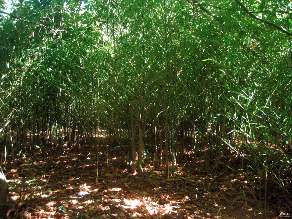
Large stands of Tritonia crocosmia, a highly invasive plant that threatens the fragile species inhabiting this ecosystem, have been detected on the fluvial-marine plain. There is also a large area covered by bamboo, another exotic and aggressive species.
To see more photos, click on our GEOLAG album on Facebook. View photos
Would you like to discover this landscape with a geologist?
GEOLAG organises educational routes adapted to families, groups and schools.
Request information about this route