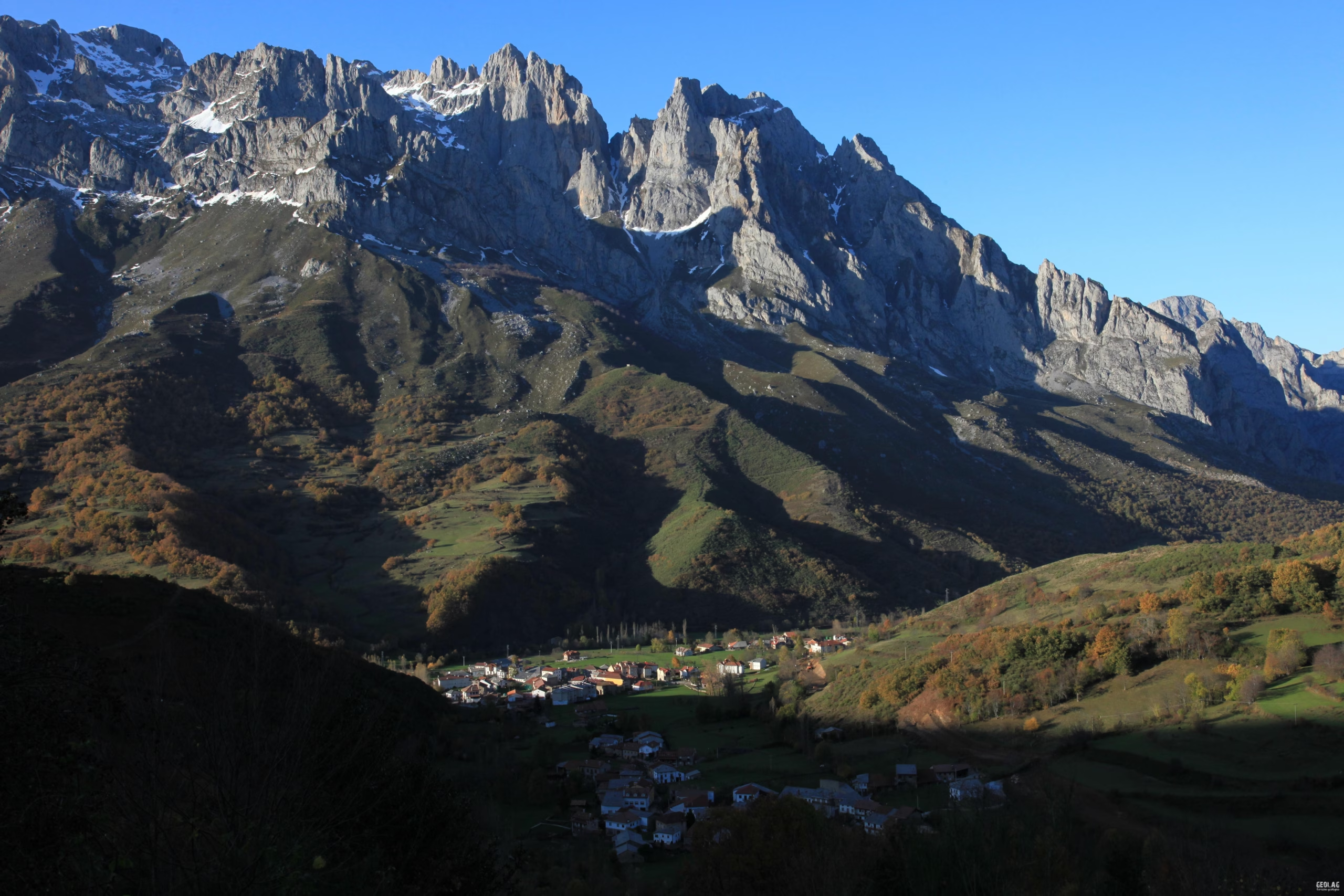
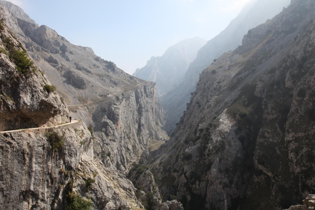
The Picos de Europa constitute one of the main limestone landforms on the Peninsula. This National Park, the second largest in Spain, consists of three massifs separated from each other and their surroundings by the Sella, Cares, Duje, and Deva rivers, which have carved impressive gorges such as the Cares, La Hermida, or Los Beyos.
The dominance of limestone has led to its individualization from the rest of the Cantabrian Mountains due to differential erosion phenomena, forming a great relief that rises among the less resistant rocks surrounding it, which constitute the valleys of Onís and Cabrales (Asturias), Valdeón (León), and Liébana (Cantabria). The presence of limestone has strongly conditioned its landscape, where karstic dissolution, acting over the last thousands of years, has shaped a relief in which lapiaz, sinkholes, and deep underground galleries are the main elements.
During the cold periods of Earth’s history, the Picos de Europa were occupied by large masses of ice which, in turn, contributed to the modeling of the highest parts, generating wide valleys, deep glacial cirques and jous, sharp ridges, and polished surfaces.
The type of rocks outcropping in the National Park is responsible for the general relief of the Picos de Europa, the appearance of its landscape, the presence or absence of surface watercourses, and the vegetation that settles upon them.
On one hand, the limestone areas, consisting of rocks resistant to erosion, form the highest parts of the Park and are characterized by an almost total absence of vegetation due to their altitude and sharp temperature contrasts. It is in these sectors where we can observe the main glacial features, numerous and varied karstic forms, as well as other forms and processes linked to periglacial environments. As these are permeable rocks, water circulation in these areas is mostly underground; thirteen of the world’s deepest caves are found in the Picos de Europa, making it a paradise for the practice of speleology.
The lower areas, located on the periphery of the three massifs, consist of softer rocks, mainly shales and sandstones—easily erodible materials that generate fertile soils on which a variety of vegetation grows, occasionally forming large forested areas. The impermeable nature of the shales means that the main river courses are concentrated in this area, and it is in these lower parts where we can observe fluvial dynamics and their interference with human use, as the main settlements are located in the river meadows.
In recent centuries, the human footprint has been reflected in the Park, with relevant archaeological remains, some of which we will visit, such as the Monte Corona necropolis, the Santa Cruz dolmen in Cangas de Onís, or the burial mounds of Vegabaño. From more modern times, the remains of intensive mining activity stand out, which at times has profoundly modified the configuration of the Picos de Europa landscape.
In this natural context, we have prepared several routes:
- The Lakes of Covadonga
- The Ordiales Viewpoint
- The Jou Santu
- The Archdeacon’s Path
- The Upper Sella
- Peña Gabanceda
- Collado Jermoso
- The Upper Cares
- The Cares Gorge
- The Áliva Passes and the Llomba del Toro
- Naranjo de Bulnes
- Bulnes
- The Ándara Mines
- La Hermida Gorge
Would you like to discover this landscape with a geologist?
GEOLAG organizes educational routes adapted for families, groups, and educational centers.
Request information about this route