Asturias enjoys approximately 350 km of rugged coastline extending between the Tinamayor Estuary, bordering neighboring Cantabria, and the Eo Estuary to the west, which serves as the border with Galicia. The Asturian littoral is predominantly represented by cliffs, typical of destructive coastlines. Constructive forms, such as beaches and dunes, or mixed forms, such as estuaries—originally formed by erosive processes and subsequently filled with sediment—appear only locally.
Rock types on the coast
One of the most important factors conditioning the shape of our coastline is derived from geological control—that is, the type of materials and their tectonic structure.
The significant differences between the various sets of materials are manifested in the landscape. This close relationship between geology and geomorphology allows the Asturian coast to be divided into three major units:
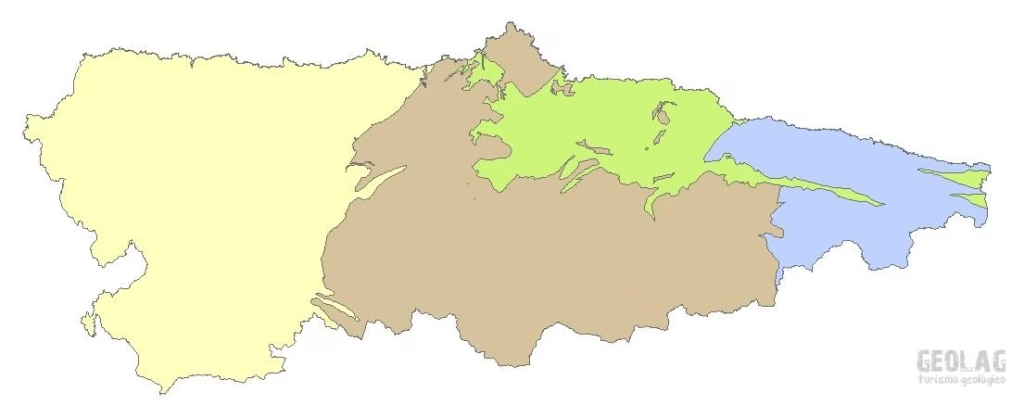
- The Central Coast: The stretch between the Nalón and Ribadesella estuaries. On one hand, it consists of Upper Paleozoic sandstones and limestones (400-250 million years old) with NE-SW orientations (brown color), upon which younger rocks are located, primarily from the Triassic and Jurassic (250-150 million years old), presenting a great variety of rock types with gentle eastward inclinations (green color). This is the location of the Dinosaur Coast discussed in previous programs. The central coast is the most diverse and heterogeneous in terms of rock types and layer orientation.
- The Eastern Coast: The stretch of coastline between the Ribadesella and Tina Mayor estuaries. In this area, Carboniferous limestones (300-350 million years old) predominate, with E-W orientations (blue color).
How are beaches formed?
The composition of beach sediment depends on its source, with three fundamental origins possible:
- The disintegration of the cliff itself by wave action, which primarily generates pebble and gravel beaches.
- Sediments of fluvial origin, which result in beaches with varied grain sizes: pebbles, gravel, or sand.
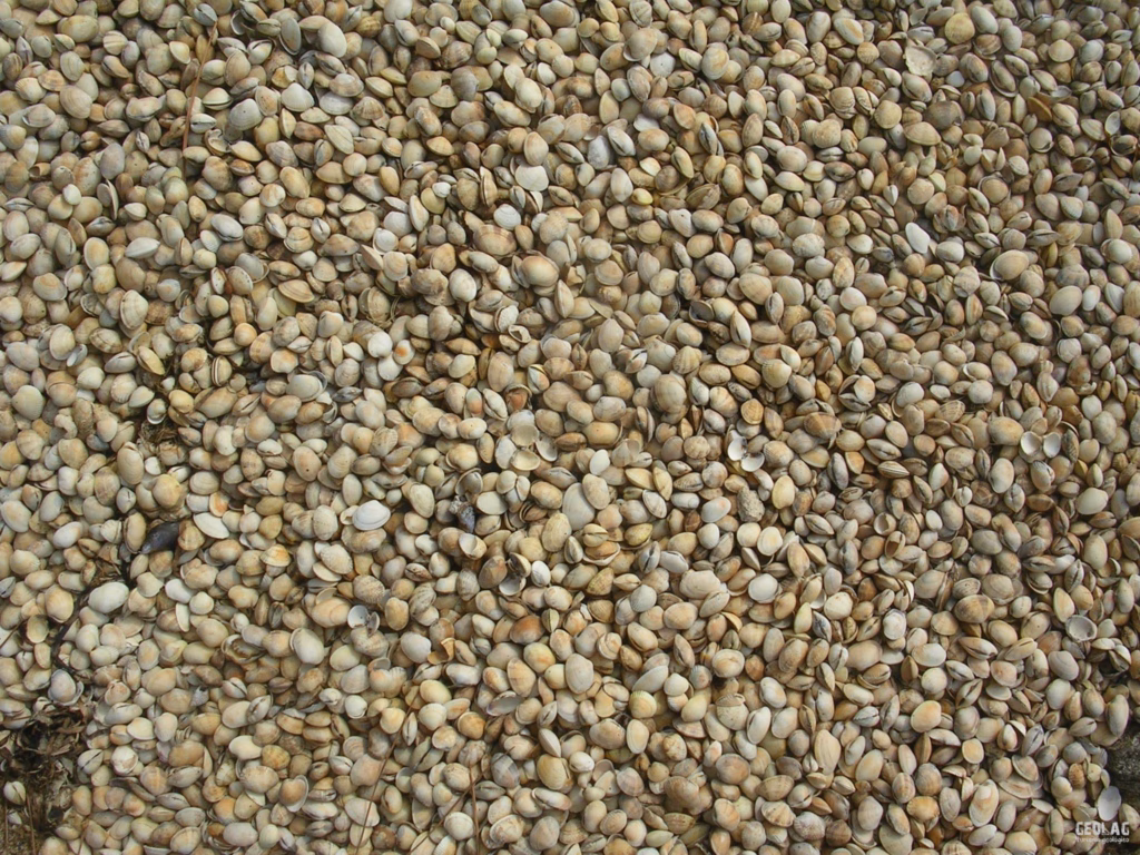
- Marine sands of biological origin, mainly resulting from the fragmentation of shells and other biological synthesis materials.
We are currently in a period where sea levels are rising (the average rate of rise is estimated at around 2-3 mm/year); consequently, wave action weakens the lower part of the cliffs, causing them to break. The resulting blocks accumulate at the foot of the cliff where they are fragmented into progressively smaller products, potentially evolving into a pebble and gravel beach, as occurs in western Asturias.
In the case of the region’s sandy beaches, the sediment origin is usually fluvial, contributed during related flood events. When this fluvial sediment reaches the coast, it is picked up by longshore currents moving eastward, depositing it along coastal inlets. The size of the deposited sediment and its distribution depend mainly on the wave energy present in the environment.
Since the sediment provided by the river is the result of fluvial erosion of the continent, its mineral composition depends on the type of rock constituting each river basin. In general, the region’s sandy beaches have a high proportion of quartz grains, the most common and durable rock mineral.
The most extensive beaches and best-developed dune fields are located east of the major river mouths, as the sediment resulting from fluvial erosion of the continent is transported in a West-to-East direction by longshore currents.
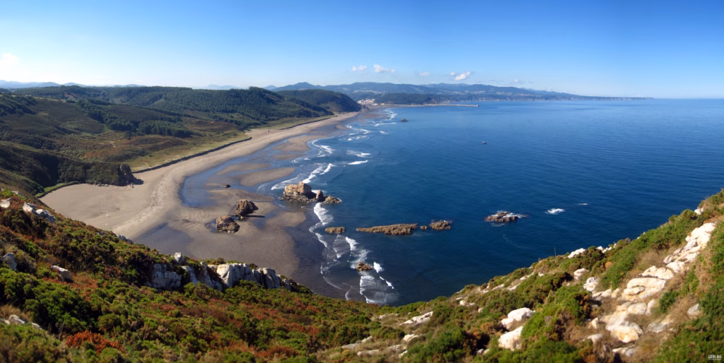
The main dune systems are located east of the mouths of the Eo, Navia, and Nalón rivers, the largest river basins. The eastern coastline, which is mostly karstic and therefore has a very sparse surface drainage network, barely features well-developed dune systems or large-scale beaches.
Cliffs and beaches by zone according to rock type
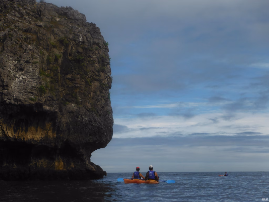
- Western Zone. From the Eo to the mouth of the Nalón. In this region, cliffs form on alternating siliceous materials. On one hand, we have sandstones and quartzites, which are erosion-resistant rocks that have given rise to the main islets and capes, such as Capes Busto and Vidio. Some levels of less resistant rocks, such as slates, also outcrop here; their presence favors the formation of inlets, most of which consist of pebbles and gravel due to the high resistance of the rocks composing most of the cliffs in this area. Examples of typical western beaches include Canero Beach, at the mouth of the Esva, or Concha de Artedo. The sandy beaches and dune fields of this region are related to the fluvial contributions of the Eo and Navia rivers, with the beaches and dunes of Penarronda, Navia, Frejulfe, Barayo, or Otur standing out.
- Central-Western Zone. From the mouth of the Nalón to Gijón. The materials are arranged perpendicularly to the coastline and are characterized by the strong contrast in resistance between the rock types appearing here. The resistant quartzites outcropping at Cape Peñas are responsible for the formation of the most important cape on our coast, where the highest cliffs in Asturias are found, reaching nearly 100 m in height. Conversely, the largest inlets in Asturias have formed by taking advantage of less resistant rocks. The presence of the Nalón River to the west—a river that collects water from nearly a third of Asturias—is the primary agent of sand supply. Upon reaching the sea, the material carried by the Nalón is transported by longshore currents, which in Asturias follow a west-east direction; this is why the largest beaches and dune fields in Asturias, such as Quebrantos, Playón de Bayas, Salinas, or Xagó, have formed in this sector.
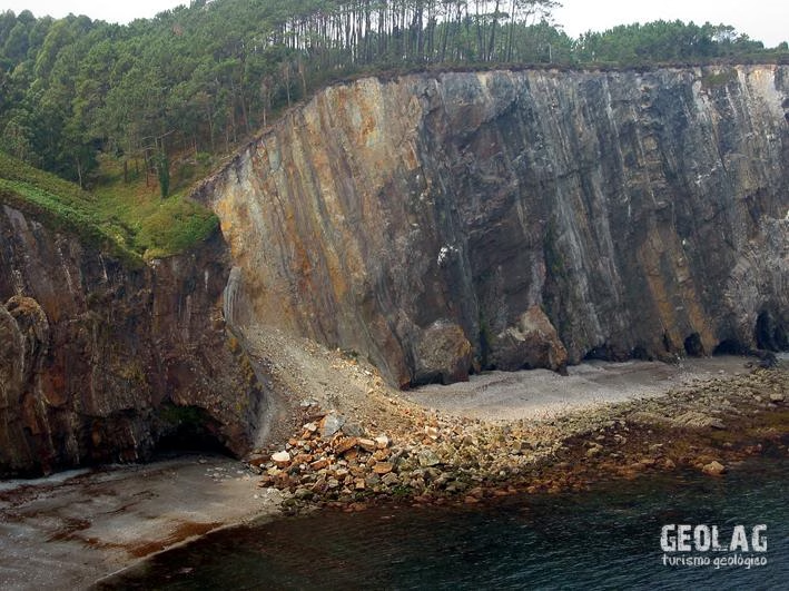
- Central-Eastern Zone. From Gijón to the vicinity of Ribadesella, the youngest rocks of our coast are found; consequently, they have barely been affected by the orogenies that raised the Cantabrian Mountains. Thus, these are little-deformed materials, favoring a very regular coastal morphology. Large volumes of slid materials exist at the base of the cliffs due to the predominance of mass movements in the cliff’s evolution.
- The Eastern Zone. This is a completely different area from the rest of the Asturian coast. The dominant presence of East-West oriented limestones imposes characteristic morphology and dynamics. The resistance of the limestones has formed vertical cliffs about 25-30 m high that evolve through large rock avalanches when the base of the cliff is undercut by wave action.
The ‘rasas’ or flat mountain ranges
South of the coastline, the Asturian coastal strip forms a narrow band of territory no more than six kilometers wide—and sometimes only a few hundred meters—clearly delimited for much of its length by coastal mountain ranges. The most characteristic element of the Asturian coastal strip are the coastal ‘rasas’, flat ranges, or plains. The ‘rasas’ constitute long, narrow plains that begin at the crest of current cliffs and step up until they merge with the mountain foothills closest to the sea. These are platforms eroded by the sea during periods when sea levels were higher, which subsequently emerged due to the isostatic uplift of the continent.
- The great western ‘rasa’. These surfaces are better preserved in quartzitic materials, which is why the ‘rasa’ is the element that dominates the entire landscape of the western coast. Since quartzites are impermeable materials, the main river courses are located throughout the west, so the ‘rasa’ appears dissected by deep fluvial valleys perpendicular to the coastline, as they take advantage of the direction of the layers in this area.
- In the eastern ‘rasas’. The dominance of limestones—permeable rocks in which karstic dissolution by rainwater has blurred the originally flat surfaces. The leveled surfaces, called flat ranges (sierras planas), are preserved only in the quartzitic levels.
Would you like to discover this landscape with a geologist?
GEOLAG organizes educational routes adapted for families, groups, and schools.
Request information about this route